
Agave Hill
NOTE: SOME OF THE INFORMATION HERE MAY NOT BE CURRENT. PLEASE GO TO THE RIO GRANDE SOARING ASSOCIATION SITE GUIDE FOR THE MOST CURRENT INFORMATION.
31.913033° -106.506967° 5,335' MSL 600' AGL Rated H/P3 or H/P2 with an instructor present
LZ 31.910659° -106.519001°
Introduction
Agave Hill is located within the Franklin Mountains State Park (FMSP) in El Paso, Texas and is the main site used within the Park. The Texas Parks & Wildlife Department has graciously given active members of USHPA permission to launch, land, and fly within the Park system, subject to the approval of the local Park Superintendent. The current sites within FMSP that we are permitted to use include this site, Nelson's and North Mount Franklin.
All pilots must register with the Park authorities before flying Agave Hill.
Do not forget to notify the Park before launching and after landing. Send a text message ONLY to (915) 539-0558 before launching and just after landing e.g. "John Doe launching from (site)" and "John Doe landed", respectively.
This is primarily a thermic site with lots of room for mistakes by newer pilots. It is an easy sled ride to the LZ. There is little ridge lift at launch so pilots must nail the house thermal to get high enough to enter winds aloft where there is some ridge lift mixed with thermals. It is flyable with winds from 220° to 320°. Best winds are winds from 240° - 260° at 8 - 12 mph average for PG. When winds are less than 240°, ridge lift is much less and there is a lot turbulence at launch from the base of N Mt. Franklin. It is also more difficult to cross Deep Sink Canyon. When winds go north of 260°, the site becomes turbulent because of the small range in front. Thermals begin to fade 60-90 minutes before sunset and you will not likely be able to bench up. Winds will go to near zero 30 minutes before sunset and the katabatic (downhill) flow will start. If conditions are weak or it is late in the day, go to Nelson's Launch instead.
We suggest that visiting pilots fly the site with an experienced local pilot because of potential hazards. Contact the RGSA.
Videos: Official Texas Parks & Wildlife paragliding at Agave Flying at Agave by Shelley McKinlay
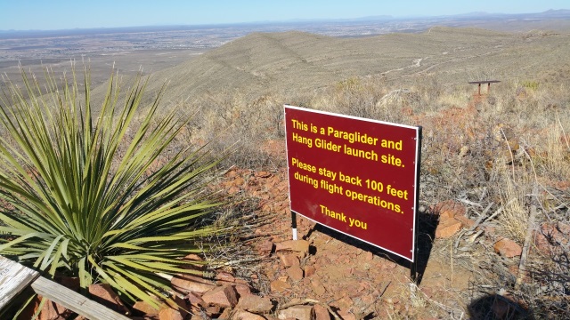
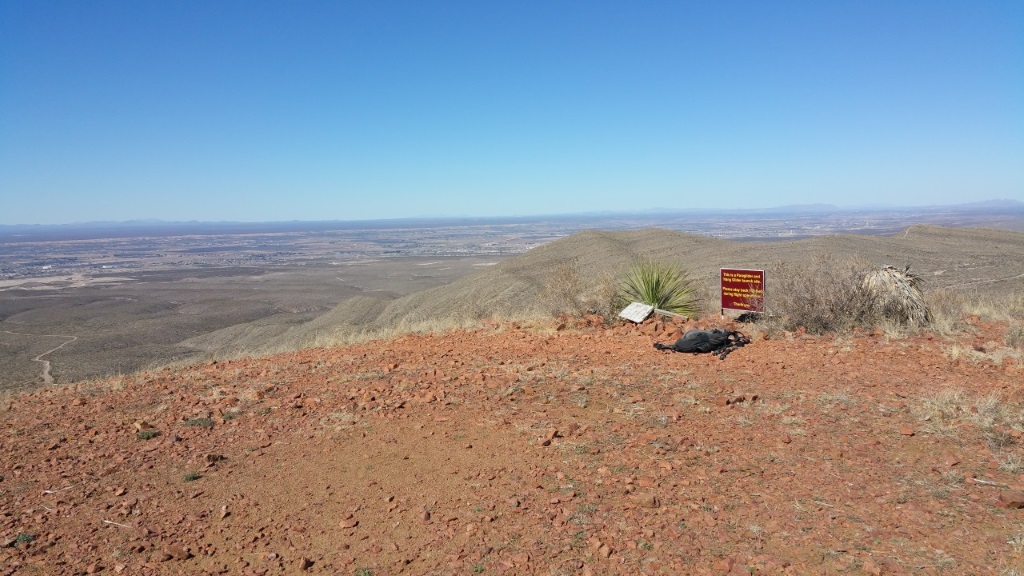
Photo by Steve Crye – also the creator of this fine sign per USHPA regulations. Believe it or not, visitors have wandered in front of gliders when they are landing and have been hit. The sites within the Park were developed and first flown by Lee Boone (deceased) and Had Robinson except Nelson's which was developed by Steve Crye and N. Mt. Franklin which was flown by hang glider pilots decades ago. We can also thank Steve for his tireless efforts in maintaining the sites within the Park and helping preserve them for all future ultralight pilots. Robin Hastings was the first hang glider pilot to fly Agave Hill.
The Franklin Mountains present exciting and challenging flying, especially for ridge and thermal soaring. Because of direct exposure to the west and with no other mountain ranges out front, the range has excellent soaring. On average days, an intermediate pilot can soar over 1,500' higher than the highest peak.
Lee Boone (deceased) checking his glider before launching from Agave Hill.
Significant skill is required to successfully fly Agave because of the transition from thermal lift to a combination of thermal and ridge lift. You will perfect your benching abilities as getting up and out is not easily done (see below for notes on how to do it). The shopping centers, parking lots, and industrial buildings west of the Park are a constant source of thermals that drift into the mountains. These thermals, combined with ridge lift, make this the amazing site that it is.
Make sure you have a GPS – you must always know your speed over the ground. At slow speeds you may be going forward or backward – make sure you know which. Altitude at launch is about the top of the daily inversion which covers the Rio Grande valley and can make the air at launch variable. Pilots need to time their launch carefully at the beginning of the cycle in order to get up and out. If there is enough wind velocity to ridge soar at launch, it means that winds above launch are dangerous and pilots may be blown back into Mundys Gap. Do not ask us how we know this.... We do not recommend benching up if you must use speedbar to stay out in front. That is, if winds are forecast >15 mph anywhere below 10,000' MSL, it is best to stay on the ground and not risk being blown over the back.
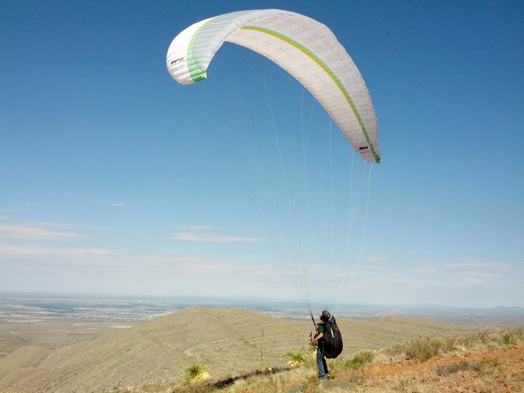
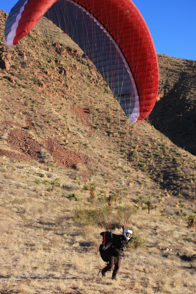
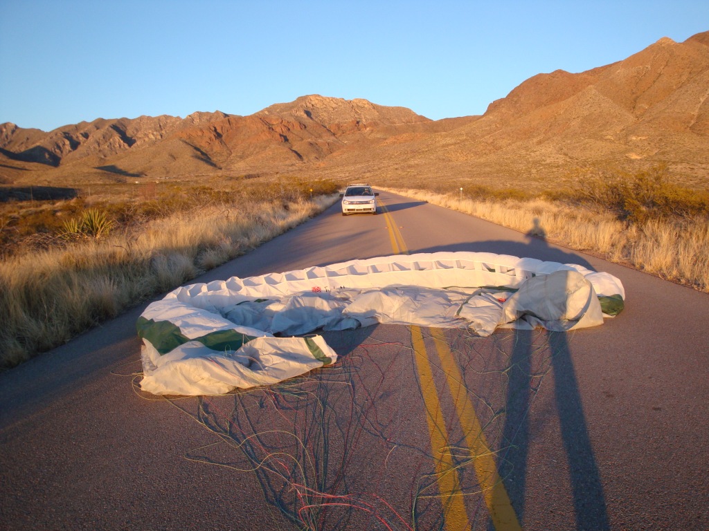
Launching from Agave – photo by Greg Rollans
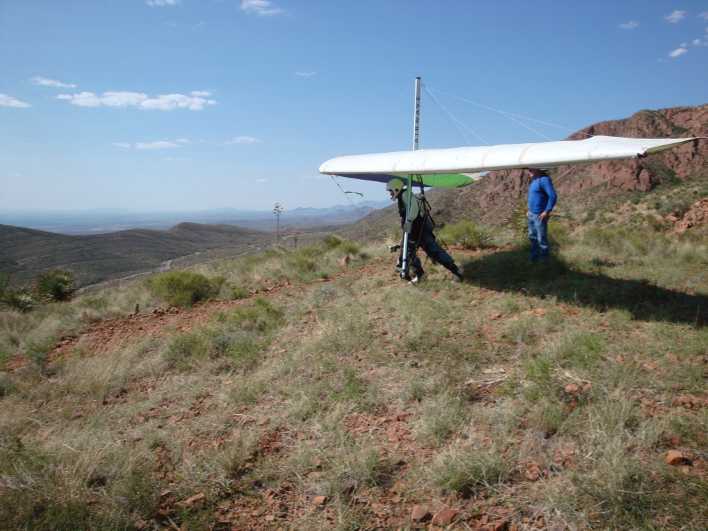
Robin Hastings launching his hang glider with help from Bill Cummings.
Gusting forecasts & Jet Stream Info: It is important to note that overhead disturbances, thermal activity, and the Jet Stream can greatly affect our flying in the Franklin mountains. Thermals and atmospheric disturbances can cause the Jet to mix down to the surface and cause dangerous sheer turbulence. If you see any gusting in the hourly forecasts or the Jet is overhead, our experience is: stay on the ground – unless you want to rock and roll.
Expectations for PG student pilots
Students launching from Agave for the first time have the advantage of a shallow slope launch that is over 50 yards in length, a broad area behind launch that is safe and open in the case of some mishap while launching, and a large area to safely land out front. The site has no rotor or obstacles out front when the prevailing winds are in effect (240 degrees).
For P2 students, winds at launch should be 240 degrees and less than 12 mph. There should be little or no thermal activity. They should stay to the left (south) as they head out and aim for the access road west of the Park check-in office. Setup is easy and forgiving as there is plenty of altitude to reach the road (the LZ). If, for some reason, the student gets low after launch, he will want to stay out of the few gullies which are directly in front of launch and, instead head for the higher parts of the slope out front or the jeep trail that goes just east of the access road before it turns northeast. The instructor will guide the student, if needed. Traffic is light on the road. If the pilot sees a vehicle coming, he should land in the bushes that are to the left of the road (south side). The downside is that his glider lines will likely get caught and this will require some time to extract them. The right side of the road may be used but it has larger bushes and is closer to the main drainage arroyo for the Park and has large rocks which the pilot could trip over when landing.
P3 students may venture up to 1.5 hours on either side of dusk and dawn to experience weak thermals out front. They can launch and fly left or right. If turning right, they can explore the house thermal and attempt to stay aloft. If they sink out, they can head for the road which goes to the parking lot for Mundy’s Gap (this is the road they drove up and then parked. The road slopes down for ¼ mile and is very easy to land on. If there is a vehicle on the road simply land right next to the road on either side. As with nearly everywhere around this launch site, there will be low bushes that will easily grab glider lines which must be carefully extracted.
All students must be alert to: 1.) the presence of vehicles on the roads (our landing areas) and land in the bushes if there are any vehicles nearby. 2.) there are arroyos out front which must be avoided because of the presence of rocks which can cause pilots to trip while landing. More advanced students can land in the arroyos (not advised) but must avoid the rocks carefully. Other than the few arroyos and the presence of vehicles there are hundreds of acres out front where a pilot can land – and walk out.
Directions to launch
Please contact the RGSA for directions.
Photo by Steve Crye
Launch
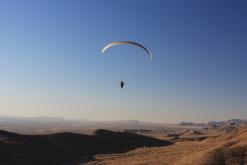
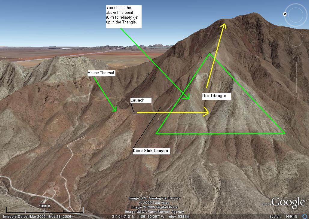
If the winds are 240° there is some turbulence at the launch face caused by the Triangle and the canyons in front but it is benign. There are no cliffs or major obstacles either in front or behind launch which means it's easy to bail in case you need to. The area in front of launch should have enough lift to get you to the house thermal north of launch if the winds are coming in over 6 mph. Once in the house thermal, pilots can get up and out. The stronger the conditions, the easier this is but the greater the risk of high winds aloft.
Stay away from the venturi at Mundy's Gap (the saddle northeast and behind launch). Do not fly behind launch unless you are certain the winds aloft (6K' MSL) are less than 15 mph (PG). Top landing at Agave is possible. Be patient getting up and out. You must utilize the house thermal that is about 100m north of launch unless the winds are over 12+. In that case, you will need to worry about being blown over the back from the higher winds aloft. Again, our advice is: stay on the ground.
Benching up from The Triangle
With a minimum of 100' (300' is best) over launch, it is possible to fly south over Deep Sink Canyon and get to The Triangle where there is real ridge lift. Steve Crye suggested this tip, "When crossing Deep Sink, especially when one has barely enough altitude, using 1/3 to 1/2 bar helps with the crossing. Get off bar as soon as you are across." If you are patient and stay in this weak lift, an adequate thermal will drift and allow you to go right to the top of the mountains (see the image below). It can be done!
The Triangle works with air the same way water runs down your arm and off your elbow. There are many ridges that go up from the base and connect at the top and so on. Thermals follow these ridges up and merge at the top. The very top of the Triangle has a sum of all the thermals going up the ridges. Thermals here have a period of about 5 minutes so you must be patient once you are aloft. Wind velocity periods are about 2+ minutes.
If you don't have the necessary height over launch, do not attempt to cross Deep Sink Canyon but continue to work the house thermal or head for the LZ. If the winds are not northwest, you can head for the road leading to the parking area from which you hiked. The Triangle is bisected by two smaller triangles at the bottom. If you are near or above the top of the smaller triangle to the north, you will be at a sufficient altitude to bench up. In other words, if you are above launch and can look straight across to the top of this smaller triangle, head across Deep Sink Canyon. You may have to ridge soar the Triangle a while as you wait for a thermal to drift in from the valley. If winds are weak, be patient! If you do not know how to turn flat and conditions are weak, you will probably sink out. Who said this site is easy? However, if you bench up (like at Point of the Mountain), treasures await!
Pilot Lee Boone (deceased) successfully benching up from launch in his UP Summit XC2.
Watch your forward speed at all times when getting high at the Triangle. If you think you are being blown backwards, apply full speed bar immediately and head straight out or south into the sinky area directly in front of N. Mount Franklin (between the ridges). You may have to juggle this maneuver with big ears. The gradients in the Franklins are substantial and going out and down will quickly get you out of the fast air. Lift is everywhere upwind of the range and you will find it a mile or more out in front 1+ hours either side of sunrise/sunset. It is not advisable to fly PG in the summer between 10:30AM and 6:30PM – the thermals are very strong and turbulence near the terrain can be unnerving. Launching in the late afternoon pretty much guarantees a smooth ride to the top. Stay within The Triangle as much as possible as there is bad sink/rotor in the canyons on either side. Once you are a few hundred feet above the top of The Triangle, you can drift back towards N. Mt. Franklin. If you find yourself going down, head back to The Triangle and try again. Be patient.
Winds Aloft
Check winds aloft before arriving at launch. If it's over 20 mph at 9K', do not fly (PG) as you can get blown over the top of the range which would be an adventure. The presence of the Triangle to the south of launch and the venturi at Mundy's Gap to the northeast always affect the winds at launch. Winds will always tend to be southwesterly regardless of whether winds aloft are much more west and even northwest. This is why it is important to have a visible windsock on the Park entrance road.
If winds aloft are too southerly (less than 240°) you will notice more turbulence at launch, no lift out front, quirky air, and, especially, the presence of sink out in front. Nonetheless, none of these conditions are particularly hazardous = sled ride to the bottom but you may not reach the LZ. Landing somewhere out front means a hike to the road and, perhaps, picking your glider out of the bushes. Stay out of the arroyos because of rotor/turbulence when landing short. Pilots have landed everywhere out front and have not experienced any particularly hazardous conditions. Stay to the south of launch as much as possible if you have to land short. It will be a pleasant and easy sled ride. More experienced pilots can land in the parking lot at the base of the trail going up to Agave and thus save themselves a long hike back to their vehicles.
Remember: This is the desert and air during mid day, especially during the summer months, can be challenging. Less experienced pilots should stick to the early AM or late PM outside the late fall and winter months. Laminar air is almost always present late in the day and dreamboat soaring in the Franklins occurs at that time. Thermals can be gigantic and sharp-edged here, as in the Owens Valley. Always check the weather or with us before flying.
LZ
The Park authorities have graciously permitted us to land on Park roads. A sled ride from launch will provide adequate altitude to land just beyond (SE of) the check-in cabana or, better, to land on the road just southwest of the parking area at the base of the trail that goes to Agave Hill. That way, you can hike back up to launch if you failed to bench up the first time. It is advisable to put up a streamer on the side of the road as wind direction can change often.
There is very little traffic on the access road which is our general LZ for all sites within the Park. When traffic is encountered, drivers will patiently wait until we clear the area – as here.
Hazards
Flying near sunset
If you land near sunset, be cautious of the katabatic flow that comes down the mountains. It can be just 20' thick, going west, and the air just above it can be moving east. Consequently, do NOT land near the mountains if it is late in the day but land on a high spot out a mile or more in front of the Park. While pilots can land safely anywhere in the flats in an emergency, it is best to stick to established roads, cleared areas, and trails. Be sure to personally check out the LZ's before using them. DO NOT WAIT UNTIL THE LAST MOMENT TO PICK OUT A SAFE LANDING AREA!
Going over the Back
If you go over the back of the range, head northeast or you will fly into the controlled airspace ("C") of El Paso International Airport that begins at the north/south Patriot Freeway (Hwy 54). The moment you sense you are going backwards, get as high in lift as you can and then once you start descending again (after you are downwind of the range), turn tail with full speed bar away from the mountains. If you can, stay out of the controlled airspace. Land anywhere safe as far away as possible from the mountains. Your ground crew or other pilots will call the airport if you must land in controlled airspace and notify them of the emergency so don't worry about that – just land safely. However, this event will never occur if you check winds aloft BEFORE flying!
Dragon's Mouth
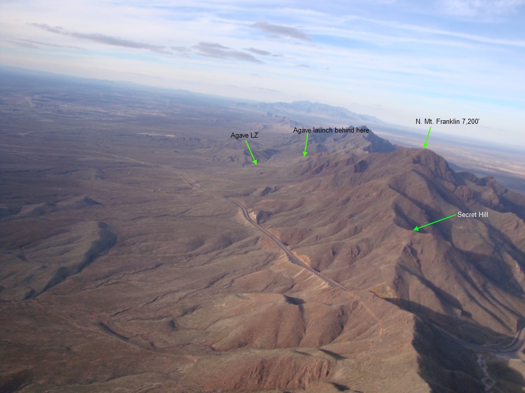
The Dragon's Mouth (DM) greatly affects the winds and lift in this part of the Franklins. When getting near or crossing Transmountain gap (State Hwy #375) from the south, it is important to be at 7,000' MSL or above as there is no lift and, if winds are >12 out in front, there is a risk of being sucked into the Pass – it is powerful venturi. When approaching the Pass from the north, the pilot will already be at 7,000' or above and there will be a slight tailwind so crossing the gap is much faster (and safer) than coming from the south. (Please see image below.)
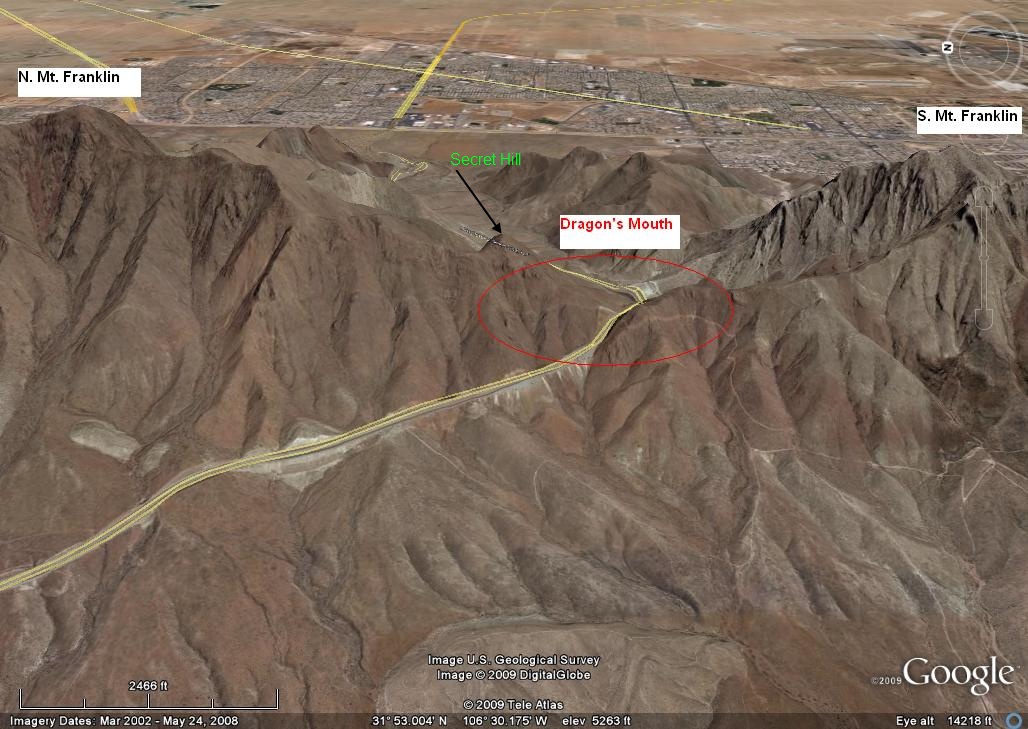
Coming north is harder. In the image above and below there is a little hill just to the upper left of the red circle called Secret Hill. If you are coming from the south, you want to be sure your starting altitude is at least 7,000' and then crab north directly over the ridge.
If winds have any component greater than 240, you will have to be much higher in order to cross DM, because you will be going upwind. It is not recommended that pilots attempt to cross the DM from the south if winds are more than 240 up to 10,000' MSL.
If you can get to Secret Hill and be level with it, you are home free. Then, just follow the ridge right back up to the top of N. Mt. Franklin. The lift is superb north and above Secret Hill because it works much like the Triangle – thermals wick up the ridges and pop off the top of this hill. Always watch your ground speed carefully! Come down immediately and land anywhere if you start going backwards. Unlike flying through gradients, you will not easily know that your airspeed over the ground is decreasing. The change starts slowly and then increases rapidly as you get near DM. Mundy's Gap should also be avoided but is nothing like the Pass at Transmountain. Make sure your speed bar is attached and working properly before launching. This is the most hazardous area of the Franklins but is easily avoided.
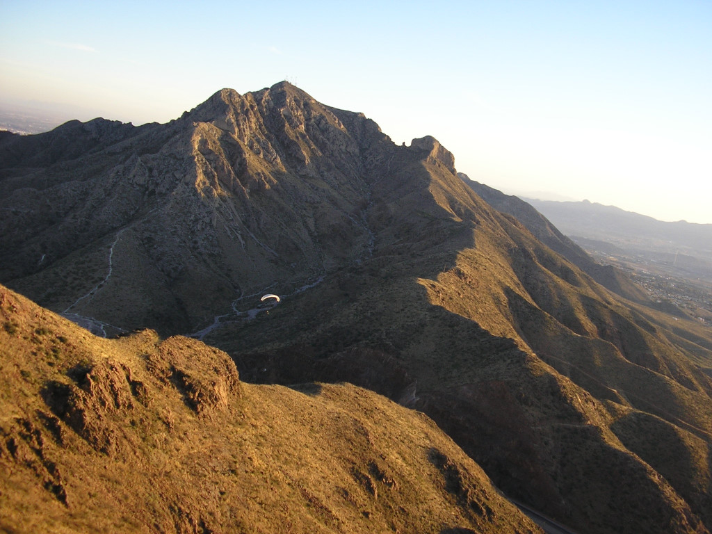
Below is the view a pilot should have before crossing Transmountain. He is well above the peak of N. Mt. Franklin (>7,200'). You will lose over 1K' crossing the gap. Stay west of the ridge by crabbing as you go north. As long as you can stay west of the ridge and move north, you will cross the gap. However, if you stop moving north it means that the wind velocity at the gap is the same as your forward speed! You can use some speed bar to continue but be careful. If you do not think you can reach Secret Hill, turn south immediately and land at the country club (easily visible with its fairways and greens). The DM is a giant sucking machine and gets worse the lower and east you go.
The pilot below is climbing up the southern spine of N. Mt. Franklin near Secret Hill.
If you get sucked into the DM, don't panic – turn east, hit the speed bar, and stay as high as you can. Follow the strong air out of the mountains which means follow the highway. It will be an adventure but probably harmless. Sometime, we will launch an RC model airplane or a helium balloon and watch it go through the DM and let the world know what happens.
Miscellaneous
It is possible to explore the canyons and ridges of the Franklin Mountains. You can top land on some of the ridges and local pilots have set up for landing on them a number of times. The only reason we can think of for doing this is if you must land quickly for some reason, like avoiding the Dragon's Mouth. You will probably have to hike out as the bushes make wing inflation difficult.
You will not enjoy flying the Franklins if winds aloft are faster than your glider's top speed. Katabatic flow down the mountains begins at dusk and makes landing more difficult as the pilot will be landing in a weak downwind = higher ground speed with the possibility of air just above going the opposite direction. Be READY for this if you plan to fly late. This daily flow is often strong enough to overcome the prevailing wind. This means that the pilot will find himself flying in air going the opposite direction as he descends below about 300' AGL. Above this altitude, the winds may still be strong enough to keep the pilot in ridge lift. When it doubt, fly to, and then land a mile or two west of the mountains as the katabatic flow will be much weaker there.
Pilot Registration
Pilots must register in order to fly in Franklin Mountains State Park.
![]()