
North Mount Franklin
NOTE: SOME OF THE INFORMATION HERE MAY NOT BE CURRENT. PLEASE GO TO THE RIO GRANDE SOARING ASSOCIATION SITE GUIDE FOR THE MOST CURRENT INFORMATION.
31.902917° -106.493700° 7,152' MSL
LZ 31.910659° -106.519001° and 31.876146° -106.519084°
Bail LZ's: PG/HG 31.871923° -106.507787° PG only 31.882664° -106.507055°
USHPA required notification: The RGSA and Southwest Airsports recommend that you do not fly at this site as it is not a chapter managed site. If you do choose to fly at this site, you must take full responsibility for your actions, and recognize that you are fully and solely liable for any damage incurred by yourself, to others, or to others’ property. This site is unimproved with significant safety issues, including potentially challenging wind and thermal conditions. Flying at this site can be risky to the pilot, property owners, and our sport as a whole. This site is unpermitted, uninsured, unmanaged, and unimproved.
General info
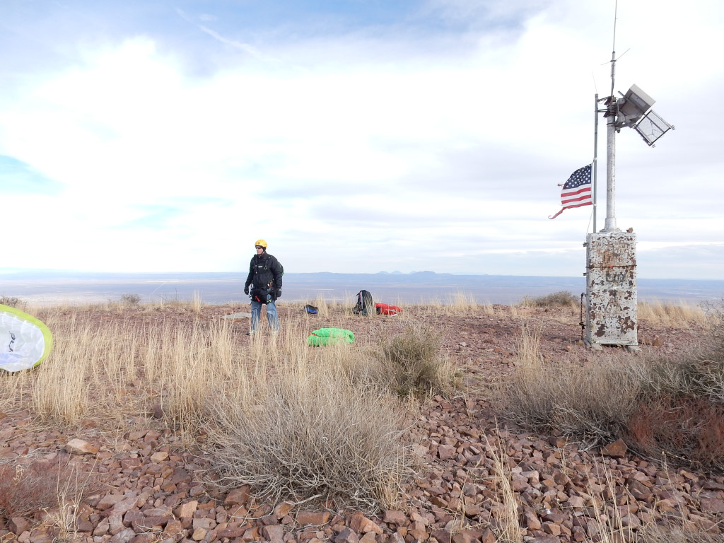
The launch is relatively free from rotor. The only obstacle that pilots should be careful of is an amateur radio tower (visible below) that extends about 15' above the flat (graded) peak. The road visible on the ground to the east is the Patriot Freeway and is the west boundary of the Class C airspace of El Paso International Airport. Always stay east of this boundary. The airspace in the Park is all Class E which is good for us up to 18,000'. Pilots should always keep a lookout for other aircraft. While launching in an easterly direction is possible in the right conditions, safe and legal LZ's may be hard to reach. Don't do it. Note: Please read the Introduction to Agave Hill for important information concerning the LZ's and sites in the Park. All pilots MUST be registered to fly any of the sites in Franklin Mountains State Park.
Flyable with winds from the west counterclockwise to the east, according to hang glider pilots. It is probably flyable with winds from any direction as the summit is unobstructed. Safest and best conditions are with a SW to NW wind. If winds are calm or light, pilots can have a 30 minute sled ride.
Winds aloft at 9K are about the same as at launch if the winds are in the same direction at both 6K' and 9K'. This means that the maximum winds aloft at 9K should be 12-16 mph for a safe launch for paragliding. It is important to launch as far forward as possible at the launch area. If there is a mishap you want time and distance to stop the glider from flying. Thankfully all sides of the peak have modest slopes without sheer faces.
BE AWARE THAT BEING BLOWN BACKWARDS OFF LAUNCH COULD BE EXTREMELY DANGEROUS AS YOU WILL FIND YOURSELF IN ROTOR GETTING DRILLED INTO UNFRIENDLY TERRAIN. WE DO NOT RECOMMEND THAT PILOTS LAUNCH IN HIGH WINDS.
There may be slight turbulence at launch in calm conditions because of thermal activity. Ideal launch conditions for PG would be when wind is 10 mph at 240° at 9K.
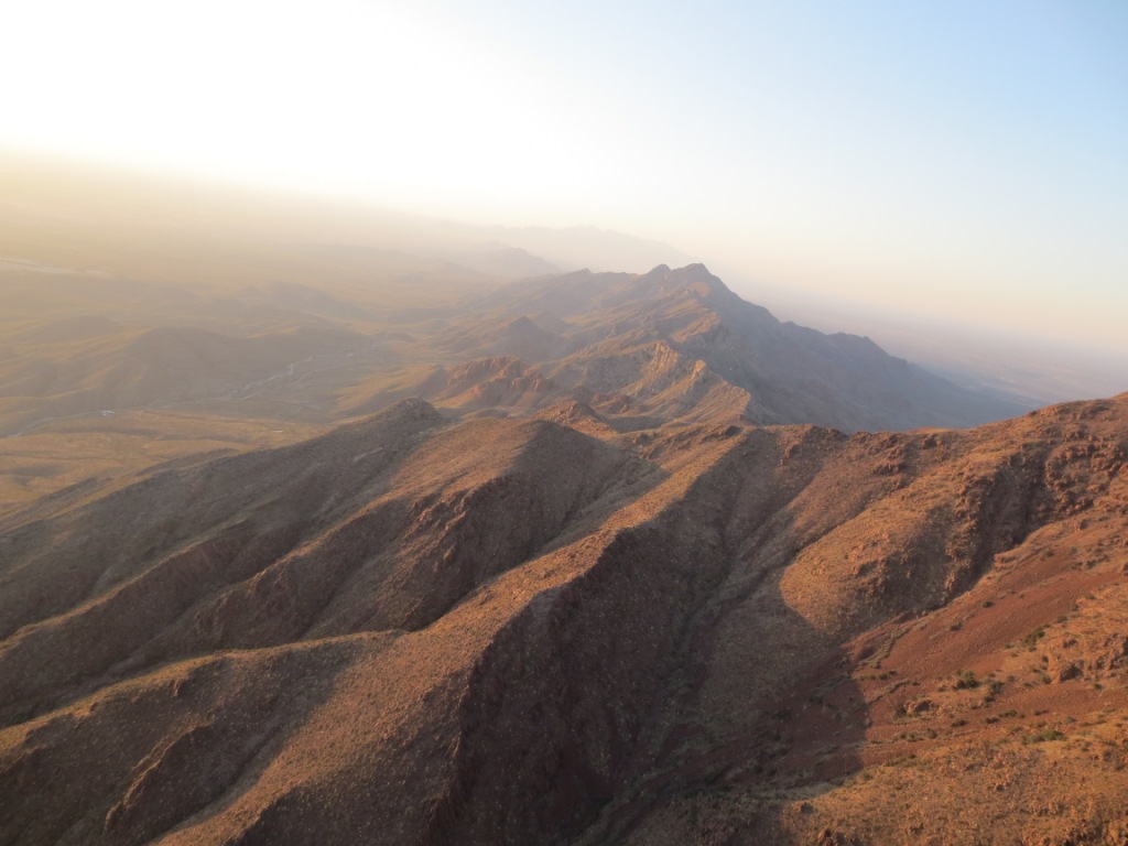
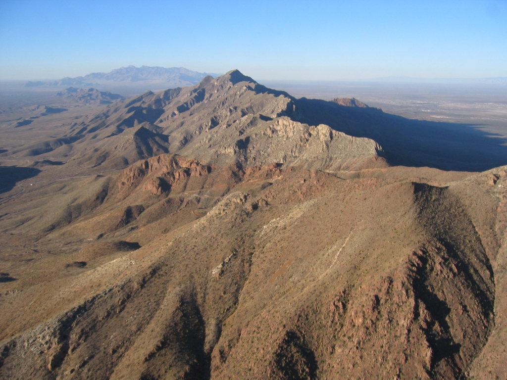
Below, looking NNW from near the summit of N. Mt. Franklin.
Site hazards and risk management
Launching from the steep slopes and cliffs in the desert mountains requires good kiting skills. It is hazardous to inflate and then immediately turn before stabilizing your glider overhead for a few seconds or more. Many pilots have damaged their equipment and been banged-up attempting to launch in the often turbulent air that characterizes the air we fly in. Pilots must have the skills to kite a glider overhead under control before attempting a launch, especially in strong air. In addition, all pilots should master inflating their gliders with the A's in one hand and the C's or D's in the other. You may have to de-power your glider at any moment and this is the only way you can safely do it while attempting a launch. Pulling deep on the brakes does NOT de-power your glider. In addition, you will not have time to go searching for the correct risers if things start to go wrong and you do not have the correct ones in your hands. Jamming the brakes will only make things worse. If you need training on how to do this, we can help.
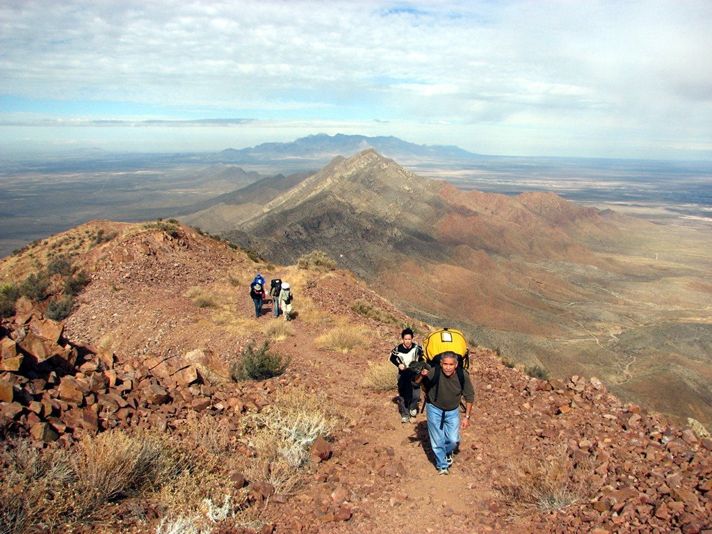
Hiking up to the summit from the north. Photo courtesy of Ken Steiner.
It requires a vigorous 2 hour hike from Tom Mays Park. The requirements to launch from N. Mt. Franklin are the same as for Agave Hill. (For detailed instructions on registering with the Park, go to the Agave Hill Information site here and read the section on Pilot Registration at the bottom of the page.)
Launch is possible when winds aloft are calm (6k'-9K') because of anabatic flow up the peak which creates a good updraft at launch (about 7 mph measured when winds aloft were calm). Winds at Mundy Gap (the high mountain pass one mile north of the summit) proved to be about the same as at the peak – both are very exposed and Mundy will experience some increase in wind velocity because of a venturi through the gap.
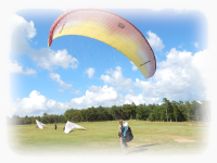
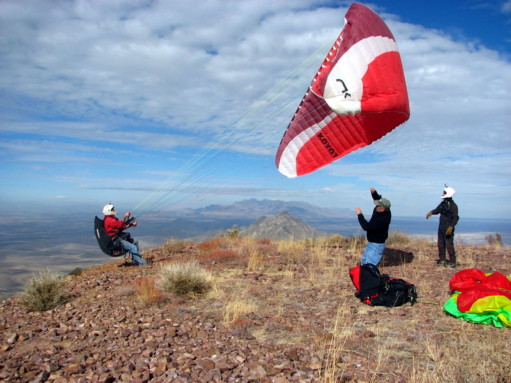
The only obstacle at the summit is a short amateur radio station. Jason Tilley preparing for launch. Jason launching in the strong conditions – it took two to hold the glider down at launch.
Benching to the top of the Franklins from Agave Hill is often a challenge but it is an easy 15 minute hike to the Agave Hill launch. However, if conditions are too mild or the wind direction is wrong, you will not be able to bench and will have to do the hike.
The late Lee Boone, pilot extraordinaire, bringing up his glider. View is north. Photo courtesy of Ken Steiner.
Looking north just in front of launch
Launching
The main benefit of this site is its altitude and the ease with which pilots can stay up, even at the end of the day or very early in the morning.
Wind direction must be from 240 degrees at a speed from 0-10. Thermal activity should be little or none which means students should not launch past/before the 1.5-hour window of dawn/sunset. Reverse or forward inflations may be done.
The area in front of launch is a shallow to medium slope for 50 yards with few obstacles. The area behind launch is similar but is steeper and has many large bushes. Be careful to launch as close to the front edge of launch as possible in order to have plenty of space to recover from a mishap. The only hazard at launch is a small 20’ tall radio tower southeast of the launch area.
After launching pilots should turn right to experience modest ridge lift and then head west when reaching the main finger that comes up from the Triangle (see the site info for Agave Hill). There is almost lift of some sort in this area, including weak thermals. Pilots should stay out of the huge bowl just west of the peak as intense sink is present there. Pilots can also turn left at launch and try their skills in the thermals coming up the spine from Dragon’s Mouth (Transmountain Pass). At any time, pilots can head northwest towards the LZ which is easy to reach even in sink. Setting up for landing in the main LZ is the same as for Agave Hill.
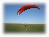
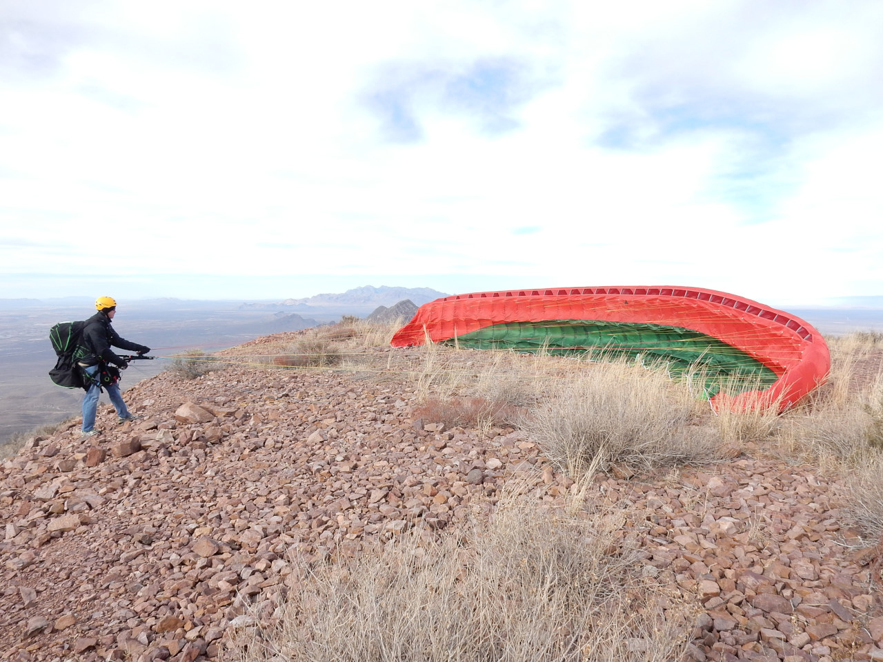
Jason Tilley "building a wall" in order to check his lines.
![]()