
Nelson's
NOTE: SOME OF THE INFORMATION HERE MAY NOT BE CURRENT. PLEASE GO TO THE RIO GRANDE SOARING ASSOCIATION SITE GUIDE FOR THE MOST CURRENT INFORMATION.
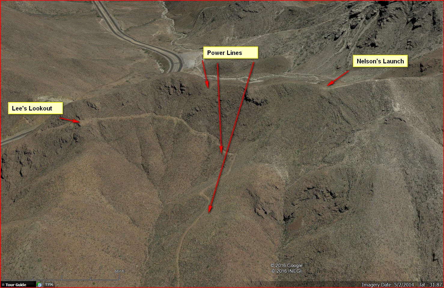
31.872852° -106.498522° 5,750' MSL
LZ 31.910659° -106.519001° and 31.876146° -106.519084°
Bail LZ's: PG/HG 31.871923° -106.507787° PG only 31.882664° -106.507055°
Introduction
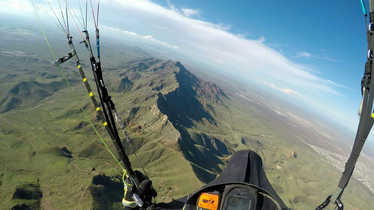
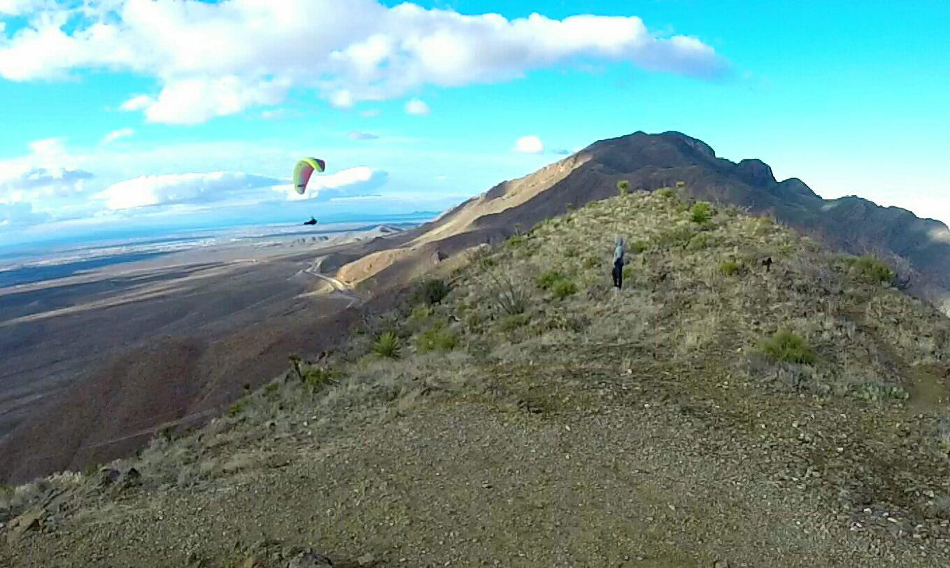
Getting high over the Franklins. Photo by Steve Crye
Nelson’s is an alternative to Lee’s Launch on days when it is too weak to bench up from Agave. It is primarily a hike and fly site for PG, but if a determined pain-resistant team can get a hang glider up to launch, the terrain is steep enough for HG. A good rule of thumb for PG is to take a wind reading at the top of Transmountain Road from the picnic area – if you measure more than 12 mph there head to Agave. Do not attempt to launch in winds less than 4 mph.
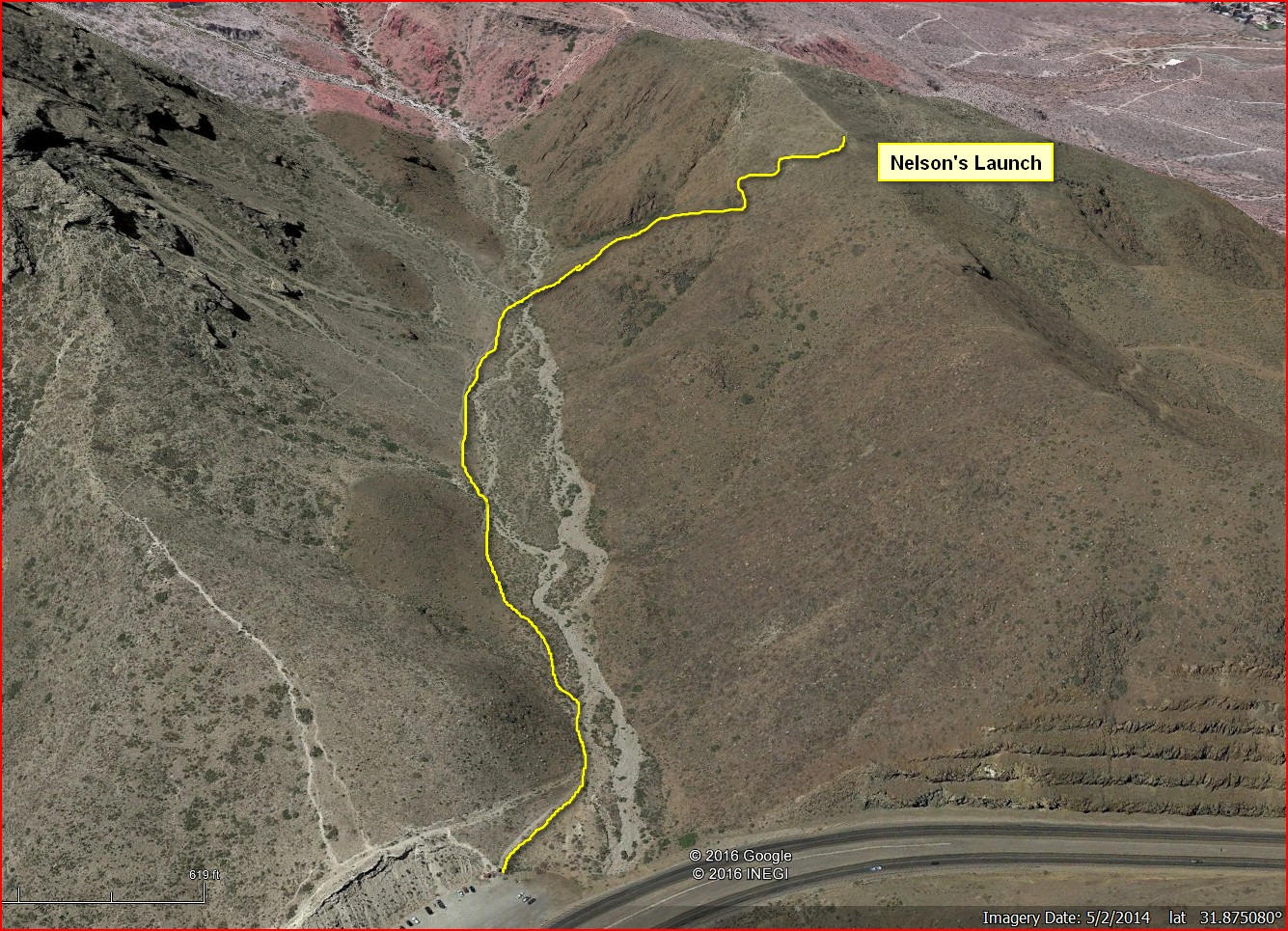
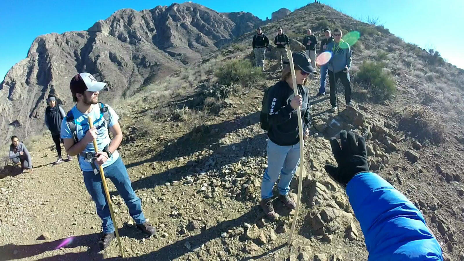
From the Ron Coleman trailhead at the parking lot, the hike to launch will take anywhere from 20 to 40 minutes depending on your level of conditioning.
We suggest that visiting pilots fly the site with a guide because of potential hazards soaring the Franklin Mountains. Contact the RGSA. All pilots must have a current USHPA membership and must register with the authorities before flying Nelson’s which is located in Franklin Mountains State Park. Record your USHPA number on the entrance form. Take the time to drive to the main entrance at the Tom Mays unit and let the rangers know you will be flying. They are very supportive of our sport and will be glad to hear you plan to fly.
Hazards and Cautions
Do not fly this site without a reserve and a functioning speed bar.
There can be considerable hiker traffic, so the pilot must stay focused. So far there has been an audience for every launch, and hikers can arrive at the site from the east with no idea that a launch is about to occur.
The terrain out front can present many hazards, due to the convoluted topography. Pilots must use caution and fly conservatively, avoid scratching and stay high above the gullies and canyons. When the wind is above 12 mph and more southerly than 240°, and particularly when thermals are present, anytime the pilot is at or below launch, there is a very real possibility of encountering turbulence strong enough to cause deflations, or sudden sink that can force the pilot into contact with terrain. When the wind is more southerly than 240°, do not fly south of launch until well above the ridge to the south, and always we ready to deal with a deflation.
There are power lines to the north, that turn south as they run down the slope to the west. Stay well away from them – always consider what could happen if you experience a deflation or have to throw your reserve above power lines.
Although it is flyable with winds from 220° to 300° (measured from the NWS station at Santa Theresa airport ), keep in mind that winds at launch will appear to be westerly even though they might be more southerly or northerly. Best winds are from 250° - 280° at 8 - 12 mph average.
Flying in the Franklin Mountains
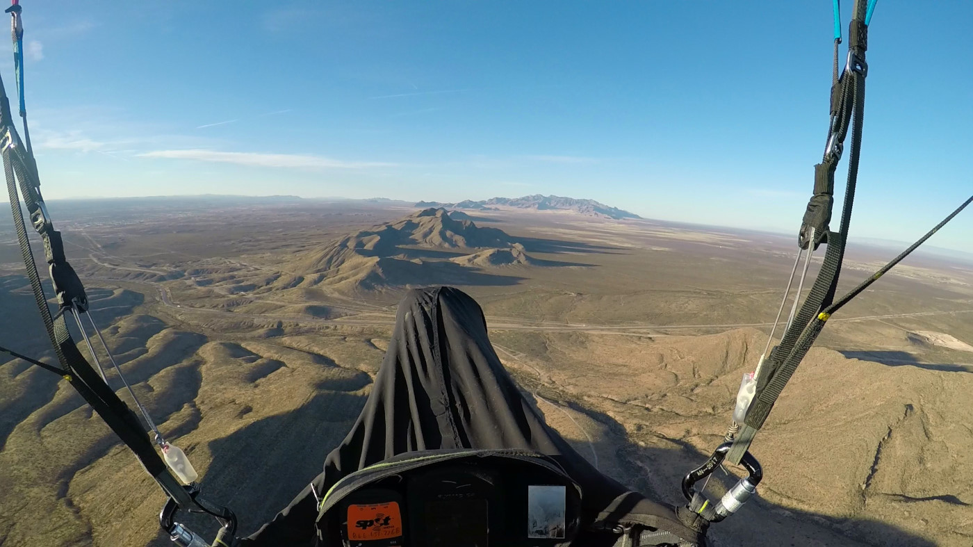
The Franklin Mountains present exciting and challenging flying, especially for ridge and thermal soaring. Because of direct solar exposure to the west and with no other mountain ranges out front, the range has excellent soaring. On good days, an intermediate pilot can soar over 1,500' higher than the highest peak. However, check the winds aloft and the Jet Stream forecast; an ideal day has no Jet overhead and no more than 20 mph at 8000’.
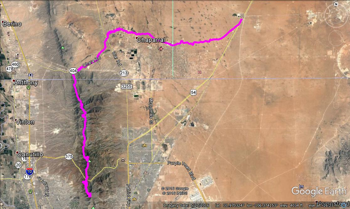
Below are the tracks of Max Montgomery's record XC flight March 5, 2017 from Nelson's to the Otero County Processing Center (jail) on Hwy 54. The distance was about 20 miles. He is the first to get to Anthony's Gap and then go east. Click on this KMZ to view or download it in Google Earth.
The shopping centers, parking lots, and industrial buildings west of FMSP are a constant source of thermals that drift into the mountains. These thermals, combined with ridge lift, make FMSP such an amazing place to fly.
Be sure you have a GPS or vario that can show your ground speed – you must always know your speed over the ground. At slow speeds you may be going forward or backward – make sure you know which. Altitude at launch, unlike Agave, is usually above the top of the daily inversion which covers the Rio Grande valley, but there will still be cycles, so time your launch to take advantage of a cycle. We do not recommend benching up if you must use speedbar to stay out in front. That is, if winds are forecast >20 mph anywhere below 8,000' MSL, it is best to stay on the ground and not risk being blown over the back.
Gusting forecasts & Jet Stream Info: It is important to note that overhead disturbances, thermal activity, and the Jet Stream can greatly affect our flying in the Franklin mountains. Thermals and atmospheric disturbances can cause the Jet to mix down to the surface and cause dangerous shear turbulence. If you see any gusting in the hourly forecasts or the Jet is overhead, our experience advises staying on the ground.
Launch
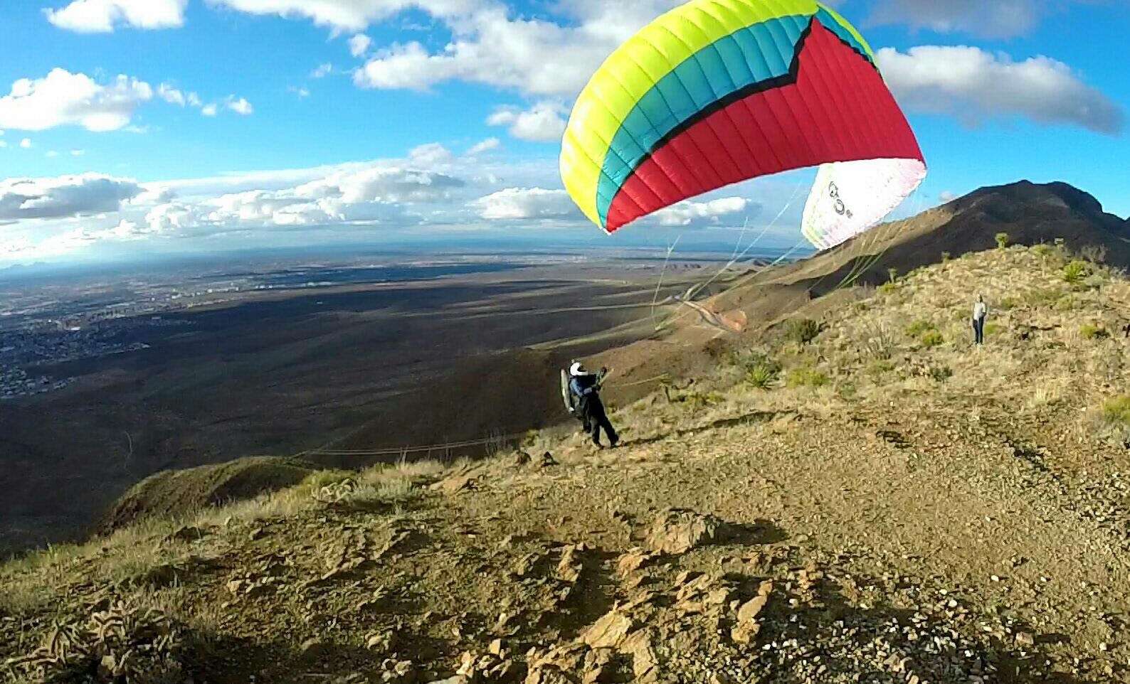
The wing can come up fast during inflation because the layout area does not see the full strength of the wind. Use caution if you measure anything higher than 12 mph, because that will generate significant rotor just 15 feet back from the point where the layout area transitions to the slope. In strong conditions, you must stand downhill and position your wing just at the top of the slope, and even then the wing will come up fast and you might be plucked; be ready to check the surge and keep a cool head. We strongly recommend that pilots use Variation 3 (A’s and rear risers) and be prepared to abort the launch at any time prior to turning to face into the wind. Abort does not mean bury the brakes! De-power your wing with the rear risers. Before flying off, if possible, kite for a few seconds to be certain everything is under control. Please take the time to remove some rocks from the runway slope below the pilot’s stance each time you visit, if we all pitch in we can make it smoother and safer!
Launching in 7 mph wind:
Immediately after launch fly to the right (north) and work the ridge between launch and the small hill south of the power lines. At any time you get more than 50' below launch, head out and slightly south. Do not get caught low in the gully in front of launch! Over the finger to the south of launch, either slightly to the north or south of the finger depending on the wind direction, there are often good thermals. Pilots have ridden these thermals all the way back up, thousands of feet over the ridge. The fingers north of the power lines are not reliable for saves, and the terrain low to the north is bad for landings.
Benching up
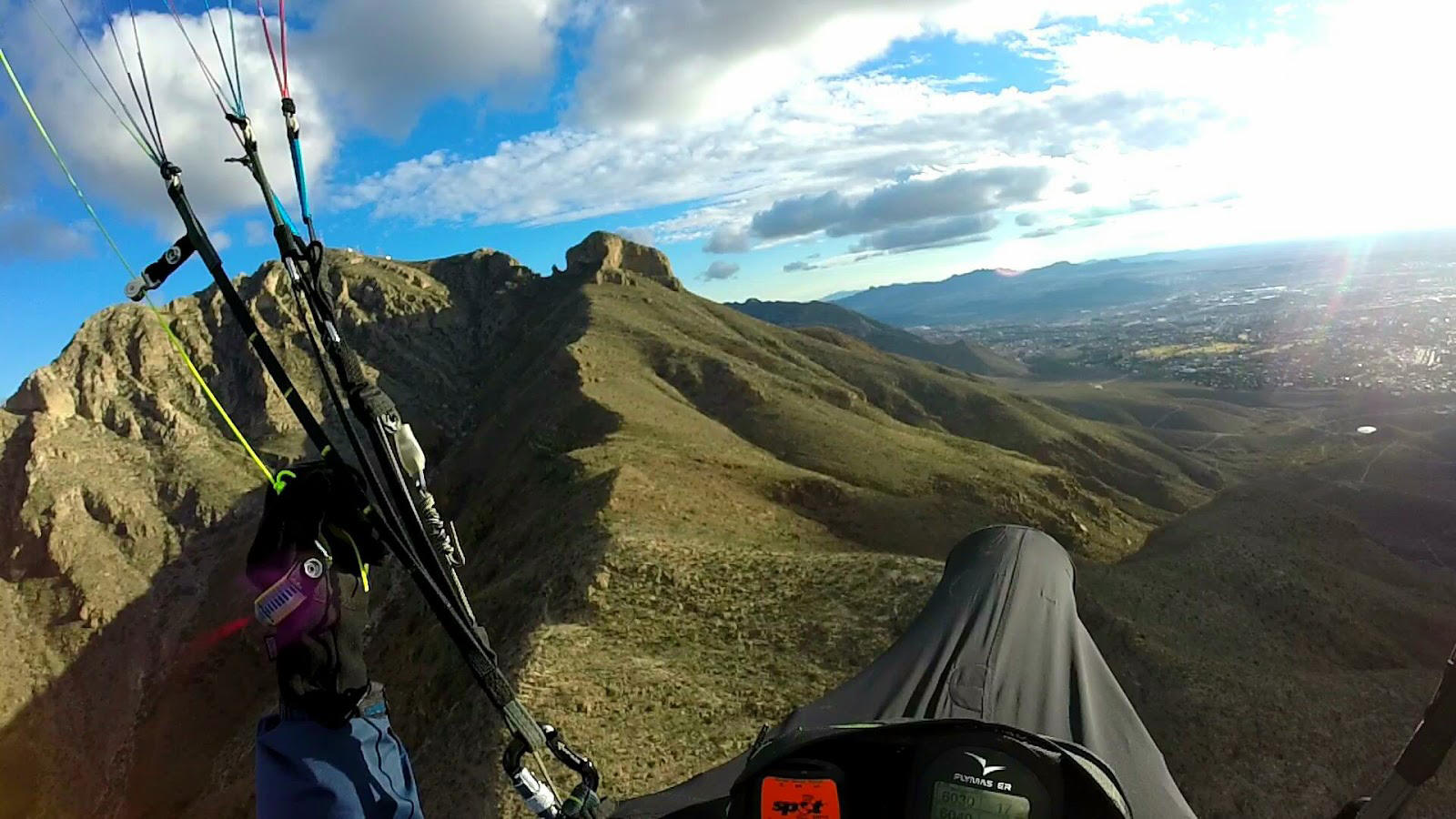
After you gain a few hundred feet over launch you can extend the your soaring to the north and the south. Stay away from the venturi at the Dragon's Mouth aka Transmountain Pass unless you are at > 7000’ , roughly level with Secret Hill. Crossing to the north of DM will let you access the highest part of the range, just use caution as you cross the DM and be prepared to turn away and back south toward launch if you encounter turbulence or start to get sucked to the east – that means you are too low and not far enough out in front; re-group to the southwest, gain some altitude and try again. See the information on the Agave Hill page regarding the Dragon’s Mouth (about 3/4's down the page).
On a good day, after the pilot gains 300’ over launch, the lift can be widespread and extend both well out front and slightly east of the ridge. Here is pilot Steve Crye doing a typical launch and landing from this new site.
Steve Crye cruising north along the top of the Franklins on his way to Anthony Gap and east. (To view his flight in Google Earth, right click on this KMZ, save it to your desktop, and open it with GE.)
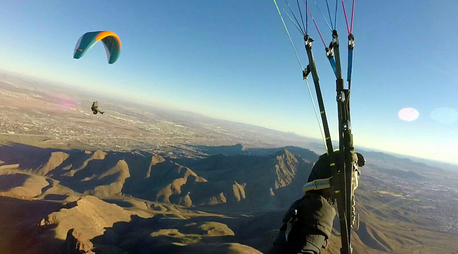
View South:
Pilots enjoying the air near N. Franklin at 8000’ after launching from Nelson's:
Do not venture into the valley to the east, it is filled with death-air rotor that is almost guaranteed to hurt you badly – not to mention the nearly invisible power lines that run across it. Don’t be tempted to land at the trailhead parking lot! Heading south should also be approached with caution; although it is possible to fly all the way to the southern end of the Franklins and back, the topography is more convoluted than to the north and pilots have experienced deflations in the area to the west of Gunsight Notch aka “The Mammoth.”
Winds Aloft
Check the winds aloft before arriving at launch. If it's over 20 mph at 8K', do not fly as you could be blown over the top of the range which would be an adventure. The presence of the Dragon’s Mouth to the north always affects the winds at launch, causing a SW component even if the winds at Santa Theresa are from the NW.
If winds aloft are more southerly than ideal (less than 240°) use extra caution to stay away from the lee (north) sides of the ridges.
Remember: This is the desert and air during mid day, especially during the summer months, can be challenging. Less experienced pilots should stick to the early AM or late PM outside the late fall and winter months. Laminar air is almost always present late in the day and dreamboat soaring in the Franklins occurs at that time. Thermals can be gigantic and sharp-edged here, as in the Owens Valley. Always check the weather or with us before flying.
LZ
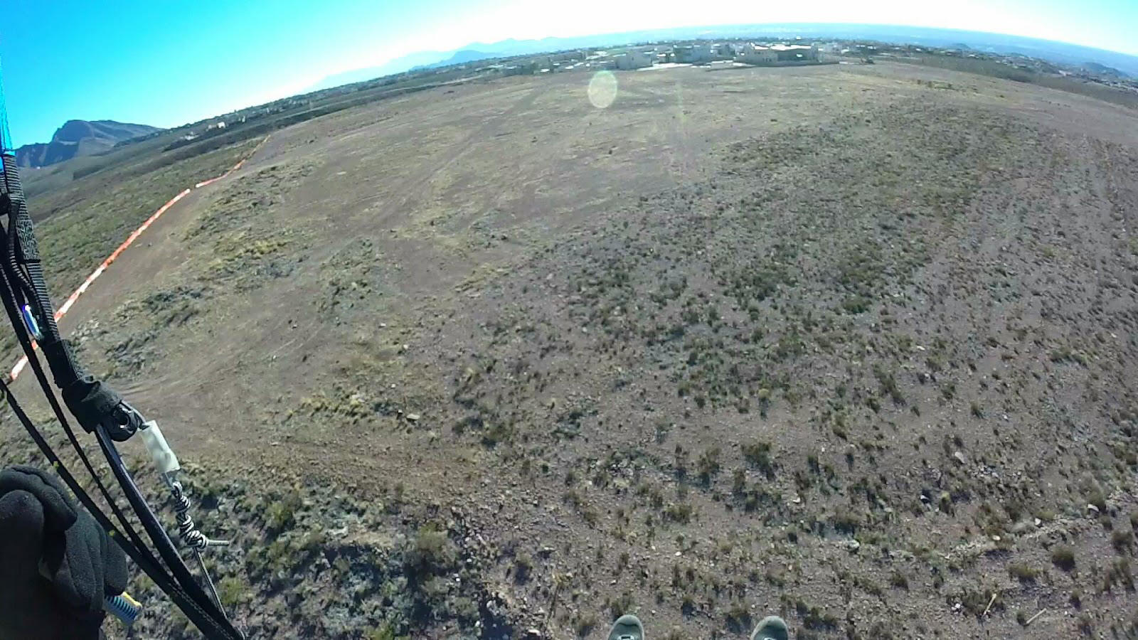
LZs are abundant to the west, and if one heads out from about the altitude of launch, it's easy to make it to the edge of the housing developments just north of Hornedo Middle school. The best plan is to fly with someone and leave a vehicle near the LZ.
The Park authorities have graciously permitted us to land anywhere in FMSP including on Park roads, but from Nelson’s there are no roads within the FMSP boundaries. DO NOT land on the city streets! Land either in a clearing, or in the flat, benign desert just to the east of the developments.
If you land just before or after sunset, be cautious of the katabatic flow that comes down the mountains. It can be just 20' thick going west and the air just above it can be moving east = do NOT land near the mountains if it is late in the day but land on a high spot out in front of the Park. Be sure to personally check out the LZ's before using them.
Going over the Back
If you go over the back of the range, head northeast or you will fly into the controlled airspace (Class C) of El Paso International Airport that begins at the north/south Patriot Freeway (Hwy 54). The moment you sense you are going backwards even with full bar, get as high in lift as you can and then once you start descending again (after you are downwind of the range), turn tail and fly at best glide (use your vario and know your wing to determine the ideal amount of bar or brake for the conditions). If you can, stay out of the controlled airspace. Land anywhere safe as far away as possible from the mountains. Your ground crew or other pilots will call the airport if you must land in controlled airspace and notify them of the emergency so don't worry about that – just land safely. However, this event will never occur if you check winds aloft BEFORE flying!
Miscellaneous
You will not enjoy flying the Franklins if winds aloft are faster than your glider's top speed. Katabatic flow down the mountains begins at dusk and makes landing more difficult as the pilot will be landing in a weak downwind = higher ground speed with the possibility of air just above going the opposite direction. Be READY for this if you plan to fly late. This daily flow is often strong enough to overcome the prevailing wind. This means that the pilot will find himself flying in air going the opposite direction as he descends below about 300' AGL. Above this altitude, the winds may still be strong enough to keep the pilot in ridge lift. When it doubt, fly to, and then land a mile or two west of the mountains as the katabatic flow will be much weaker there.
Pilot Registration
Pilots must have a current USHPA membership and register in order to fly in Franklin Mountains State Park. Record your USHPA number on the entrance form.
![]()