
Mt Riley, Dona Ana County, New Mexico
NOTE: SOME OF THE INFORMATION HERE MAY NOT BE CURRENT
31.925850° -107.063050° 5,903' MSL
LZ 31.914165° -107.065059°
Bail LZ's are everywhere around the north, south, and east base of the mountain but may require miles of hiking back
to a road.
USHPA required notification: The RGSA recommends that you do not fly at this site as it is not a chapter managed site. If you do choose to fly at this site, you must take full responsibility for your actions, and recognize that you are fully and solely liable for any damage incurred by yourself, to others, or to others’ property. This site is unimproved with significant safety issues, including potentially challenging wind and thermal conditions. Flying at this site can be risky to the pilot, property owners, and our sport as a whole. This site is unpermitted, uninsured, unmanaged, and unimproved.
This site was developed and first flown by PG pilot Had Robinson. It has yet to be flown by a hang glider pilot.
Flyable with winds from south to north.
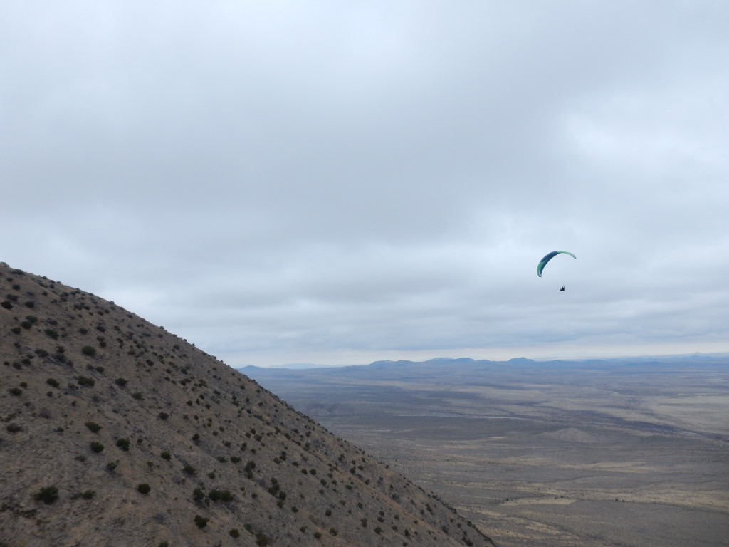
Visiting pilot, Jeroen Kusters, working a weak thermal northeast of the peak in late December.
This is one of the prettiest and benign mountain sites for soaring and XC in the SW. The top is clear and smooth with neither obstructions, vegetation, nor rotor. Top landings are possible. Launching is easy and safe as the top is a smooth cone all the way down. The southeast face has darker rock and is a good thermal generator. If flying other than with a north to south wind, do not venture into the wind shadows created by Mt. Cox or Mt. No-Name. Launching from Mt. Cox is possible but it is a much longer and more difficult climb as there are no roads near its base. The top is about as good as Mt. Riley. Steve Crye was the first pilot to launch from Mt. Cox.
Here is a skew-t of a balloon sounding at Santa Teresa which illustrated a day when conditions at Mt Riley were good for soaring.
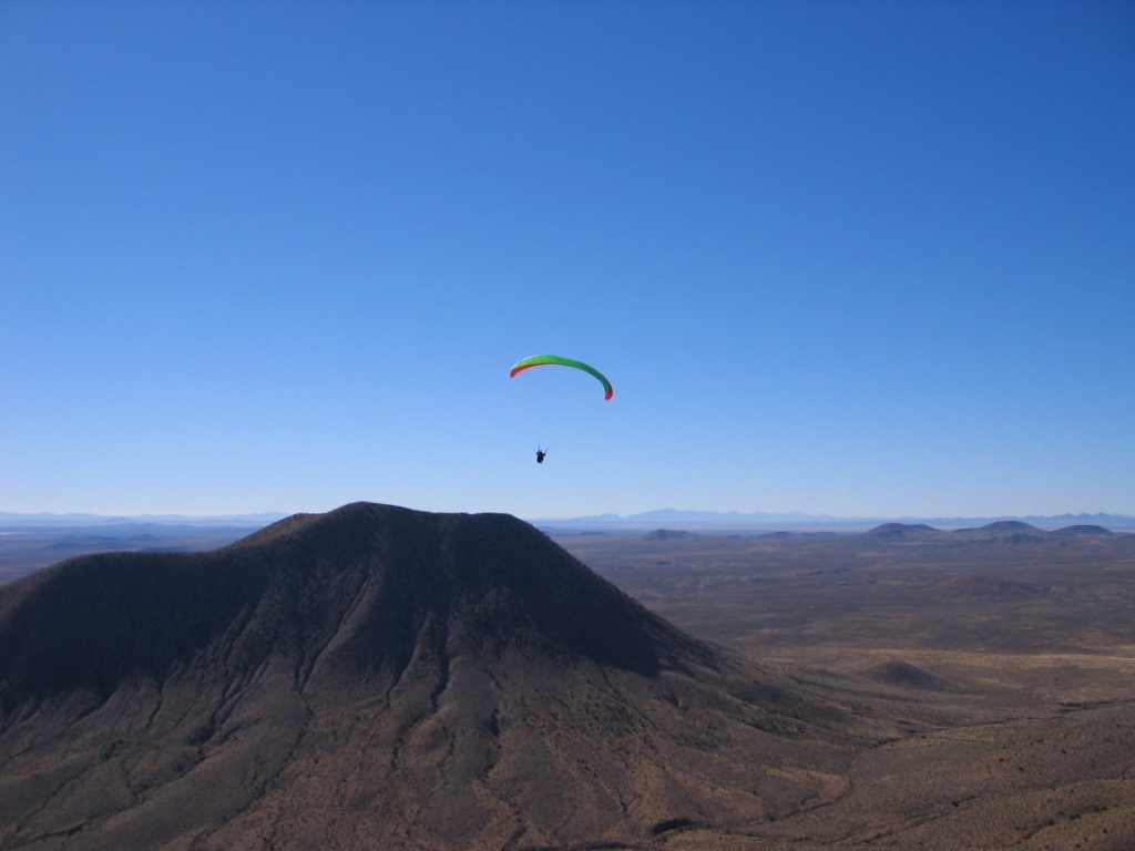
Denae Nemanic, the first woman to ever fly from the summit, heads out from the northwest face of Riley into buoyant air (she is already above launch). Mt. Cox is in the distance. Winds were NW and light that day which made launching with such a huge object upwind of little concern.
The site requires a 45 minute (1,000' vertical) hike to the top from the southwest side. We plan to find a much lower launch site that will allow benching to the top. Thermals are abundant, of course. XC is easy from here. Ridge lift will take the pilot well above the summit and "jumps" to the East Potrillo mountains should be easy where ridge soaring in easterly or westerly winds are possible. The base of Mt. Riley is accessible by 4 wheel drive only. This is a Federal Wilderness Study Area and open range – be sure to watch for (and respect) the cattle that are here and there.
A guide is recommended for first time visitors. Contact the RGSA for directions. Visitors can camp anywhere in this region but always respect the fragile desert environment. Note: a New Mexico permit is required to take a vehicle in this area.
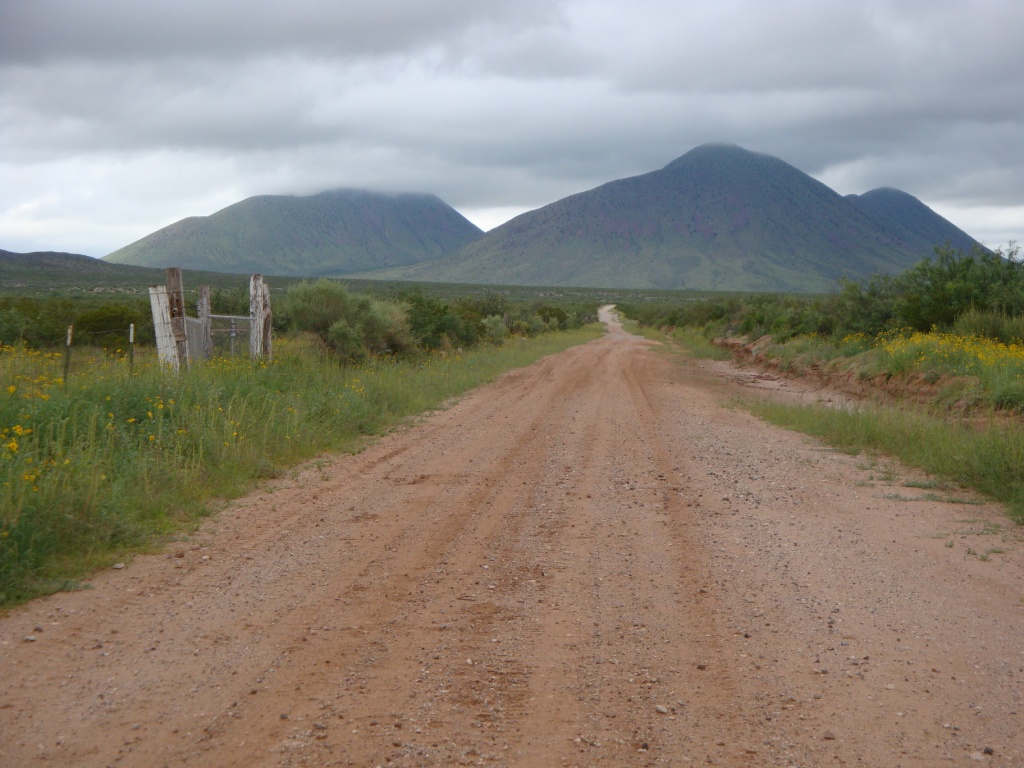
Mt. Riley is the mountain in the middle. Mt. Cox is to the left and Mt. No-Name is to the right. The fence is the northern boundary of a ranch that runs cattle in the area. This is a remote part of the continental U.S. – dark sky to the west all the way to Yuma, AZ. If you want to be really alone, this is the place.
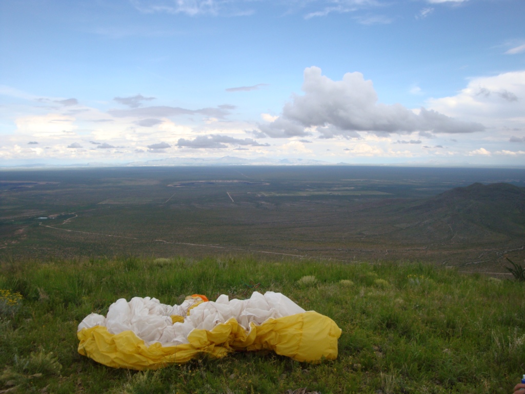
Launch looking ESE. The two maars – Hunts (middle) and Kilbourne (middle left) are just visible. The East Potrillo mountains are just visible to the right.
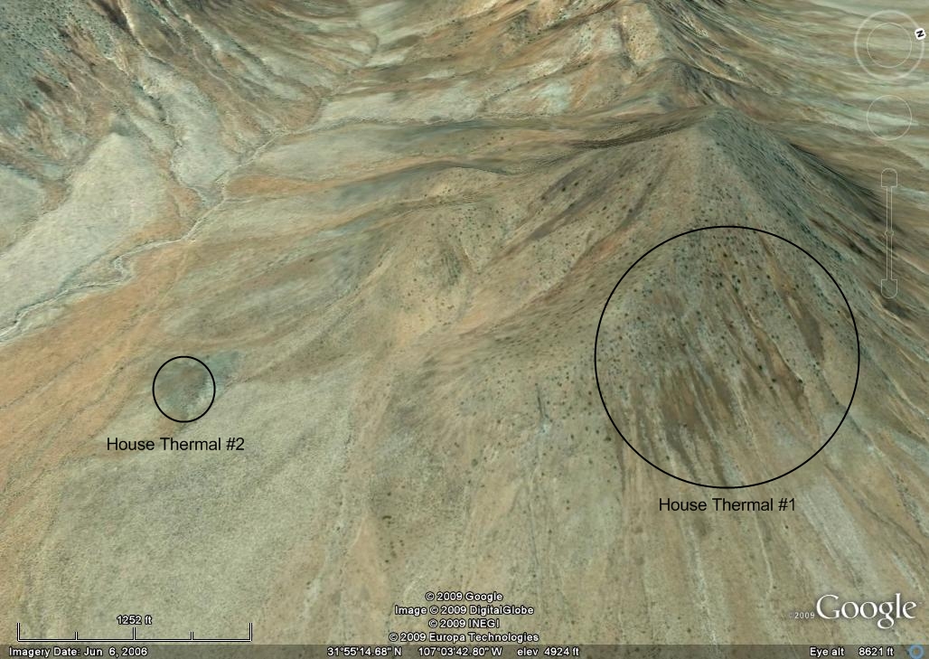
These (2) spots generate a lot of heat when the sun hits them and are among the regular thermal sources of the area. House thermal #2 is a small hill just 200 yd. wide at the base and 100 ft. high. Thermals stream up from both of these areas continuously when the sun is directly over them. #2 works better in the PM. #1 is good to about noon and then goes into the shadows after that time. #1 can be a point of air convergence during the afternoon if the wind is from the east so the pilot is flying in both ridge and thermal lift at the same time.
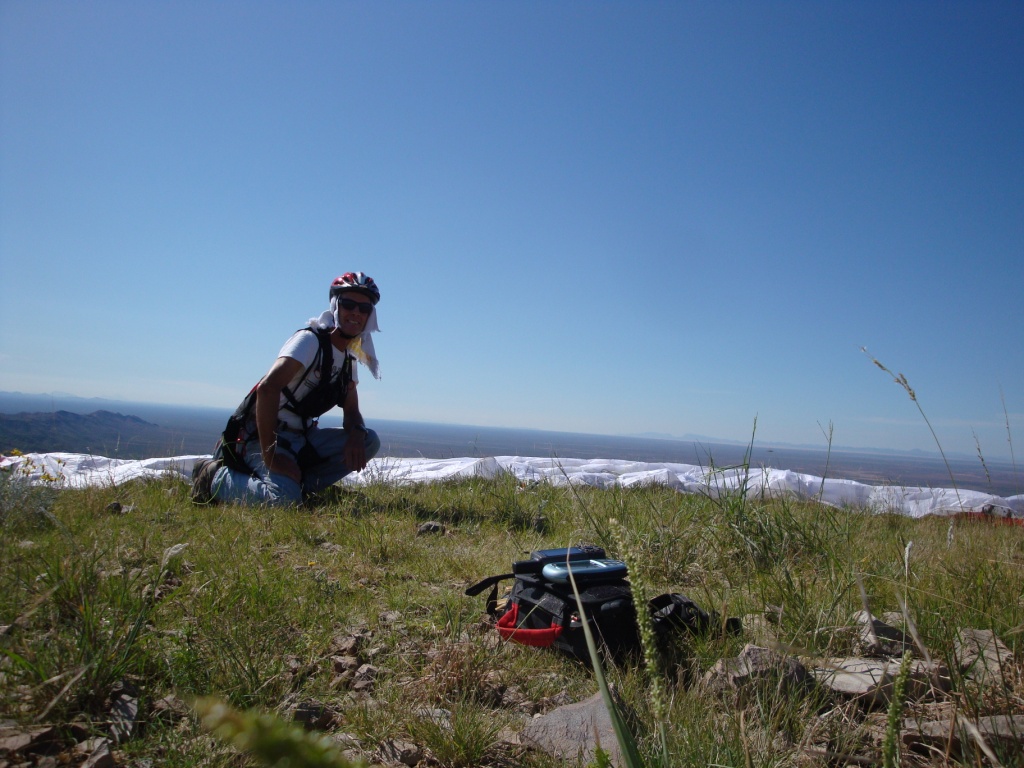
Had Robinson preparing to launch from the summit. The view here is south with Mexico in the far background. Mt. Riley is one of the few mountains that can be flown from nearly any direction. In good conditions, a pilot can do cross country or go "ridge jumping" as there are other soarable ridges nearby.
The road to the base – 4 wheel drive only. Note: Cell phone service out here is sporadic but better than years earlier. Some will work from the summit.

![]()