
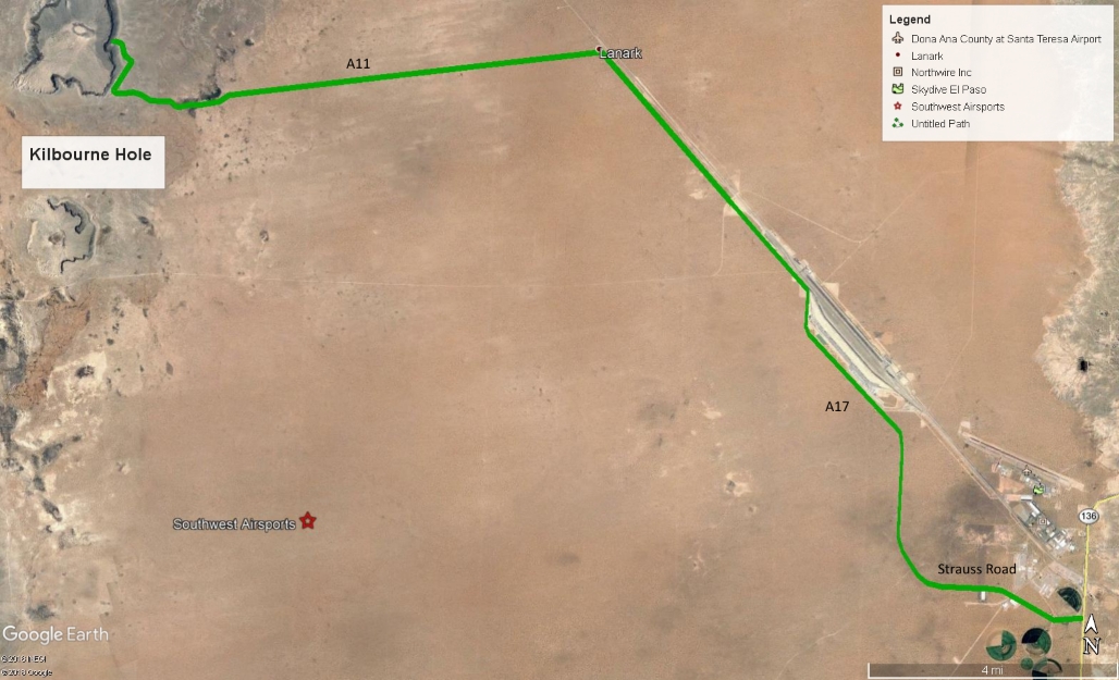
Directions to Kilbourne Hole maar
East launch 31.968833° -106.953967°
Turn off of Hwy 136 (Pete Domenici Hwy) onto Strauss Road and go to the end of pavement where it turns into A17. Continue on A17 until a stop sign (A20), make a right, then a quick left and continue on A17. It is about 12 miles to A11. A11 is the first left past a dumping area of many piles of black rock on the west side of A17.
Once on A11, go west 8 miles and arrive at the maar. Make a sharp right turn and go along the outside base of the maar 3/4 miles. Cross a cattle-guard. Make a sharp left and follow the jeep trail about 0.3 miles. Then make a left turn and go 0.13 miles to the top of ridge. The jeep trail up to the ridge from the base is 4-wheel drive ONLY. If your vehicle cannot make it, do not worry because you are just 100 yards from launch. At the top of the ridge, make a left and go south 60 yards. You are at the East launch.
Note: Taking a GPS along is highly recommended.
![]()