
Guadalupe Ridge
NOTE: SOME OF THE INFORMATION HERE MAY NOT BE CURRENT. PLEASE GO TO THE RIO GRANDE SOARING ASSOCIATION SITE GUIDE FOR THE MOST CURRENT INFORMATION.
Launch 1,600' AGL, launch 6,000' MSL, H/P3 rating
PG launch 32.2605710º -104.8963580º
HG launch 32.2537955º -104.8933776º
LZ 32.2618089º -104.8919299º
Camping 32.2614743º
-104.8945816º
USHPA required notification: The RGSA and Southwest Airsports recommend that you do not fly at this site as it is not a chapter managed site. If you do choose to fly at this site, you must take full responsibility for your actions, and recognize that you are fully and solely liable for any damage incurred by yourself, to others, or to others’ property. This site is unimproved with significant safety issues, including potentially challenging wind and thermal conditions. Flying at this site can be risky to the pilot, property owners, and our sport as a whole. This site is unpermitted, uninsured, unmanaged, and unimproved.
General info
The Ridge is located in the Lincoln National Forest, Otero County, NM. This site is governed by the National Forest Service rules which require that visiting pilots be accompanied by a Rio Grande Soaring Association member.
The designated PG and HG launches are the most popular, but dozens and dozens of sites along the 50+ mile ridge will work.
The entire ridge is in the TALON MOA. Although there are no prohibitions against flying in the MOA, check with the CONUS FSS (800-992-7433) to see if there are any scheduled training flights, and to let them know you will be operating there. Camping is free, excellent and close to launch. This is one of the darkest sites in the continental USA and that combined with the 6000’ elevation and dry air make the seeing unbelievably great. It's dark enough to see the Zodiacal light pre-dawn. The nearest town is Queen, where there is superb cell phone service. Be sure to stop in at the Queen Store and Cafe and say hi to Lynn and Kimberly Ballard. They make fabulous food, the pies and burgers are particularly noteworthy. They know about the fly-in , and are supportive. 575-981-2439
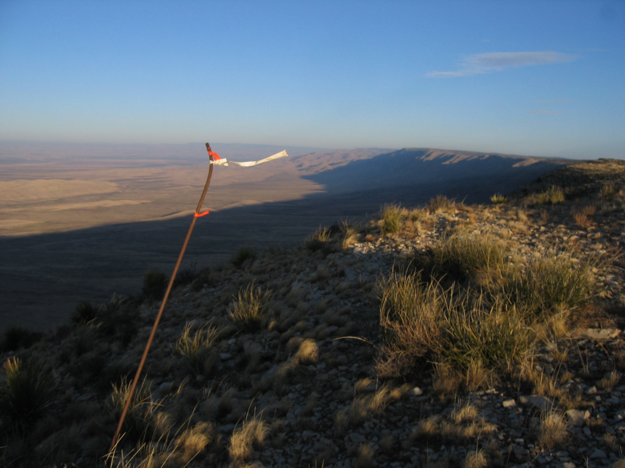
The view from launch looking west

This is a thermal and ridge-soaring site northwest of Carlsbad, New Mexico. It’s rated H/P 2 with prior mountain experience. It is the rim of a vast valley that runs about 20 miles due north & south, and may be flown in wind directions ranging from Southwest to due West. The valley is flat and grass covered, about 6:1 from launch, and can be landed anywhere. The site is marginally suitable for top landings because of the steep face of the ridge. When the winds are more than 5-7 mph, the rotor behind launch extends east at least a 1/4 mile. A PG pilot was hurt in the rotor in December 2000. If a top landing is desired, be certain that you have enough altitude to fly behind launch far enough to get out of the rotor.
Guadalupe Ridge looking north from launch
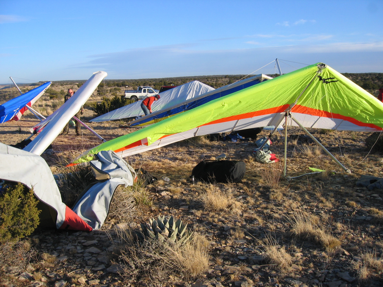
The setup area can accommodate 50 gliders (HG or PG) at once. The most commonly used launch is a dirt slope about 50 feet long, sloping down at 45 degrees. In winds of 20 mph or more, the site becomes turbulent, and a wire crew for HG becomes essential. This site can get very windy indeed, and blowouts are common. Plan to fly early! A sled run is typically 5 to 10 minutes in duration; soaring flights of several hours are also common.
The 2008 Presidents Day RGSA fly-in at the Ridge
As of the year 2009, no XC flights have been made from this site. Access is by a graded 2WD road on US Forest Service land. Access to the LZ in the valley involves an almost-4WD section of dirt road, however. This site is popular for club campouts, and is very remote. Take lots of extra food, water and gasoline. Sitting Bull Falls, a popular recreation site for swimming in spring-fed pools, is a 2-hour drive from the launch site. Contact RGSA members for directions.
Site hazards
Because of the remote location, potential pressure to top land in dangerous conditions, significant rotor and numerous rocky ravines on the lower two thirds of the slope. Pilots must have extensive experience with top landing and mountain launches in strong conditions.
In strong conditions and pilots are plucked off launch and unable to penetrate forward, they will end up in the rotor right behind launch. DO NOT LAND MORE THAN 10 FEET BEHIND THE TOP OF THE RIDGE!! Either skim the ridge and land right on the lip, or gain a minimum of 300’ (500' is best ) and fly back 500 meters to land in the designated LZ.
Another option is a side hill landing (PG only) about 200’ below the PG launch. That slope is about 20 degrees and free from rocks and cactus. The same slope can be used to launch in strong conditions, and should be used in winds 15-20 mph instead of the top launch area.
If you are having trouble with any of the top landing methods, DO NOT TOP LAND! If you are sinking out and are unable to side-hill land, pick a spot on the plains below, as close to the ridge as possible. There is a deer path up to the PG launch. In-shape people can do the climb in an hour. Fat old pilots will struggle for three hours (Steve Crye's advice). Bring water, food, hiking poles and sun protection.
![]()